





Today, Google released a major update to its popular Google Maps app. Anyone using public transport in Warsaw can now track the live location of buses and trams. This means that when planning a trip, you can check whether your bus is running late.
Tracking the location of buses and trams in Warsaw is an interesting extension of Google Maps' ability to plan public transport journeys. In addition to stop locations and timetables for individual lines, passengers now have access to comprehensive data on real-time traffic conditions. This makes it easier to predict whether they'll arrive at their destination on time.
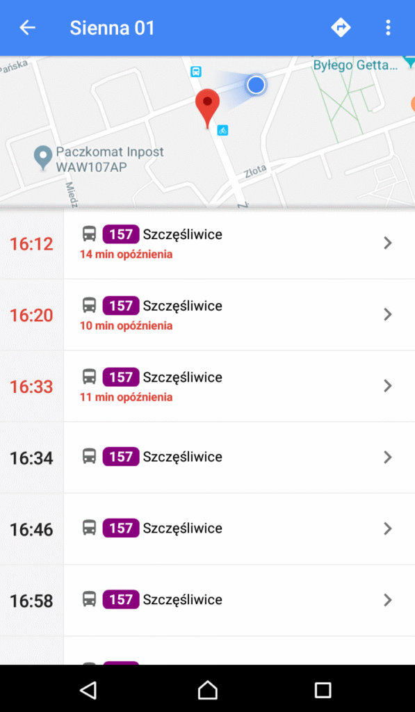
Google Map displays bus or tram departure times in different colors:
- Green means no delay
- Red indicates a vehicle that is late at a given stop.
- Black means there is no information about the location of a given vehicle (unfortunately, even Google has missing data)
More information on this topic can be found in Google Maps HelpVehicle location data comes from shared city resources (more on this topic In this article)